Home
Members
Bushcraft
Equipment
Geocaching
Mapping
Contact
Mapping Section
The following links are for mapping and coordinate conversion applications we use and would recommend. These are all free to the public and available to anyone with a computer and a modem.
Mapping Applications
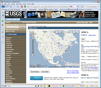
The USGS Store
Web-based Application
The USGS serves the Nation by providing reliable scientific information to describe and understand the Earth; minimize loss of life and property from natural disasters; manage water, biological, energy, and mineral resources; and enhance and protect our quality of life. USGS offers some free 7.5 Minute Maps in PDF format (check the location of interest to download or order).
Terraserver-USA
Web-based Application
The TerraServer-USA Web site is one of the world's largest online databases, providing free public access to a vast data store of maps and aerial photographs of the United States. TerraServer is designed to work with commonly available computer systems and Web browsers over slow speed communications links. The TerraServer name is a play on words, with 'Terra' referring to the 'earth' or 'land' and also to the terabytes of images stored on the site.
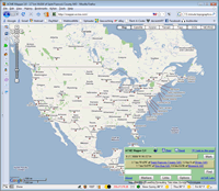
ACME Mapper
Web-based Application
ACME Mapper is a front-end for Google Maps and Terraserver, a large geographical database. Improvements made here: A command to consolidate the map tiles into a single JPEG for saving; A marker showing the actual point specified, on both the tiled navigable page and the savable image; Simple and accurate latitude/longitude input and output, so it should be more useful for people with GPSs; Zooming in and out is also more accurate - you don't get lost.
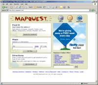
MapQuest.com
Web-based Application
MapQuest.com: The leader in helping consumers find anyplace in the physical world over any connected device. Ranked within the top 10 most powerful U.S. brands on the Internet by NetRatings and as both the number one mapping site and number one directories site by comScore Media Metrix, MapQuest.com is the world's leader in helping consumers find anyplace in the physical world over any connected device. MapQuest.com receives more than 37 million visitors every month.
Nasa's World Wind
Downloadable Application
NASA has released World Wind as an open source program to improve its quality through peer review, maximize awareness and impact of NASA research, and increase dissemination of World Wind in support of NASA's mission: To inspire the next generation of explorers ... as only NASA can.
Coordinate Conversion Applications
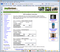
Jeepreviews.com
Web-based Application
Translate coordinates (WGS-84, NAD-83, and NAD-27) to and from Latitude/Longitude and UTM. Also, if the location is within the conterminous 48 states, you'll get the converted coordinates for the other map datums.
GEOTRANS
Downloadable Application
GEOTRANS (Geographic Translator) is an application program which allows you to easily convert geographic coordinates among a wide variety of coordinate systems, map projections, and datums. GEOTRANS runs in Microsoft Windows (95 and NT) and UNIX Motif environments.
MICRODEM
Downloadable Application
MICRODEM is a microcomputer mapping program written by Professor Peter Guth of the Oceanography Department, U.S. Naval Academy. It requires a 32 bit version of Windows (NT/2000/XP or 95/98/ME).
|
Home
|
Members
|
Survival
|
Bushcraft
|
Equipment
|
Geocaching
|
Contact
|
Copyright 1996-2016 GeoCorps.com. All Rights Reserved.
Site created by
Warhog